
Local Guide · NW Metro Atlanta
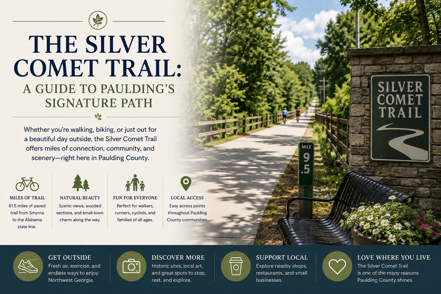
The Silver Comet Trail is NW Metro Atlanta's signature rail-trail: a paved, motor-free path that follows an old rail line from Smyrna in Cobb County west through Paulding and on toward the Alabama line, where it joins Alabama's Chief Ladiga Trail for a combined route of roughly a hundred miles. Flat by Georgia standards, shaded for long stretches, and open to cyclists, walkers, runners, and skaters, it is the kind of amenity that shapes how a whole county lives, and in Paulding especially, it does.
I mention the Silver Comet in more buyer conversations than any single park in my markets, because proximity to it genuinely changes daily life. This guide covers how the trail runs, where to get on it, the landmarks worth traveling to, and the practical tips that make a first visit smooth. It joins my outdoor guides to Paulding and Cherokee counties.
Key Takeaways
- The trail runs paved and motor-free from Smyrna through Cobb and Paulding toward the Alabama line, connecting with the Chief Ladiga Trail beyond.
- Its railroad heritage keeps grades gentle, which makes long distances feel achievable for casual riders and walkers alike.
- Multiple trailheads with parking serve the Cobb and Paulding stretches, so you can start close to home and travel either direction.
- Landmark features, long trestles and a genuine tunnel farther west, give outings natural destinations.
- For nearby neighborhoods, the trail functions as a daily amenity, and it shows in how people choose their streets around it.
"The Silver Comet changed how Paulding sees itself. I have clients in Hiram and Dallas who chose their street by its distance to a trailhead."
Marna Friedman, REALTOR®, Atlanta Communities
Where does the trail run, and what is it like?
The Comet begins near Smyrna in southern Cobb County and heads generally west: through Cobb's suburbs past Powder Springs, into Paulding through Hiram and past Dallas's orbit, then onward through open country toward Rockmart and Cedartown in Polk County before meeting the Chief Ladiga at the state line. Because it was built on a railroad bed, its grades stay famously gentle; the miles roll rather than climb, which is exactly why a casual rider can cover distances here that would be unthinkable on ordinary Georgia hills.
The character changes as the counties do. The Cobb miles are the busiest and most connected, weaving through neighborhoods with frequent road crossings and steady foot traffic. The Paulding miles open up: longer wooded stretches, fewer crossings, and a countryside feel that makes the middle trail many regulars' favorite. West of Paulding the trail earns its long-distance reputation, quieter and more rural, with the landmark features that reward committed riders. Wherever you join, the surface is paved, mileposts mark the way, and every non-motorized traveler shares it, so trail etiquette, announcing passes and keeping right, is part of the culture.
Where should you get on the trail?
| Access area | Character | Good for |
|---|---|---|
| Smyrna area (eastern start) | The trail's busy beginning, services close by | First visits and short social miles |
| Powder Springs | Mid-Cobb access near the town's center | Town-to-town rides with a lunch stop |
| Hiram | Paulding's busiest gateway, retail nearby | Convenient starts with everything at hand |
| Dallas-area trailheads | Quieter Paulding access into wooded miles | Peaceful out-and-backs west |
| Rockmart and west | Rural miles toward the tunnel and state line | Long-distance days and landmark rides |
Trailhead parking, restroom availability, and amenities vary by location and change over time, so check current details through the county's resources at paulding.gov and the trail's official information pages before a first visit to an unfamiliar access point. The reliable pattern: the closer to Cobb, the more services; the farther west, the more self-sufficient your outing should be.
What landmarks give a ride a destination?
Two features headline the trail's western reaches. The Pumpkinvine Creek Trestle in Paulding carries the trail high over its namesake creek on a long, historic rail trestle, one of the most photographed spots on the entire route and a satisfying turnaround for rides starting in Hiram or Dallas. Farther west near the Paulding-Polk line, the Brushy Mountain Tunnel sends the trail straight through the ridge, a genuine, lit rail tunnel whose cool air announces itself before the entrance does; passing through it is a rite of passage for Comet regulars. Between and beyond them, the trail collects smaller pleasures: creek crossings, rock cuts where the railroad carved through hills, long green corridors of shade, and the small-town main streets, Rockmart's among them, that the old rail line was built to connect.
For riders who keep going, the Chief Ladiga connection at the Alabama line turns the Comet into the eastern half of one of the Southeast's great rail-trail journeys, and completing the full crossing is a bucket-list day for area cyclists. Most outings are far humbler, and the trail is generous to both: the same path serves a two-mile evening walk in Hiram and a hundred-mile ambition equally well. Regulars build their own traditions on it, the same coffee stop, the same trestle turnaround, the same stretch where the woods close in and the road noise disappears, and that repeatability is quietly the trail's best feature.
What tips make a first visit go smoothly?
- Pick distance by honesty, not optimism: flat miles are still miles, and an out-and-back means every mile out is owed back. Ten to fifteen round-trip miles is a satisfying first ride for most casual cyclists.
- Carry water and sun plans: shade comes and goes, services thin out west of Hiram, and Georgia heat rides the trail all summer. Spring and fall are the glory seasons, and the shoulder months reward whoever shows up on the first cool morning of October.
- Time the crowds: weekend mornings are the trail at its liveliest, weekday mornings at its calmest; the Cobb miles feel crowds first.
- Mind the crossings: road crossings concentrate in the eastern half; treat each one as a full stop regardless of what the traffic appears to be doing.
- Practice the etiquette: announce your passes, keep right, keep pets leashed and close, and the whole shared-path system works the way it is meant to.
What does the trail mean for nearby living?
Amenities like this one reorganize the map around themselves. In Paulding, neighborhoods within an easy pedal of a trailhead treat the Comet as their linear park, the after-dinner walk, the Saturday ride, the training route, and buyers increasingly ask about trail distance the way an earlier generation asked about golf. The effect is strongest around Hiram and Dallas, where the trail, the parks system, and the county's new construction corridors overlap; more than one client has toured a community and measured its worth partly in minutes-to-trailhead. Cobb's trailside neighborhoods, from Smyrna through Powder Springs, show the mature version of the same pattern.
It also travels well as a regional asset: the Comet pairs naturally with the area's other outdoor anchors, Kennesaw Mountain's hiking, Lake Allatoona's water days, into the kind of active weekend map I sketched in day trips from NW Metro Atlanta. Few metro areas hand you a flat hundred-mile path; this one starts in our backyard.
Frequently Asked Questions
How long is the Silver Comet Trail?
The Georgia trail runs roughly sixty miles from Smyrna to the Alabama line, where it joins the Chief Ladiga Trail for a combined route of about a hundred miles. Most visitors ride far shorter out-and-back segments.
Is the Silver Comet Trail free?
Yes, the trail itself is free to use, with free parking at public trailheads. Check current trailhead details through official county and trail resources before visiting a new access point.
Is the trail good for casual riders and walkers?
Very: the railroad grade keeps it gentle, the surface is paved, and no motorized traffic shares it. Distance is the only real variable, so plan the turnaround honestly.
Where is the trestle everyone photographs?
The Pumpkinvine Creek Trestle in Paulding County, a long historic rail trestle over the creek, reachable as an out-and-back from the Hiram or Dallas-area trailheads.
Is there really a tunnel on the trail?
Yes, the Brushy Mountain Tunnel near the Paulding-Polk line, a lit former rail tunnel the trail passes straight through. It is a favorite destination for longer rides.
When is the best season for the trail?
Spring and fall are the sweet spots; summer works with early starts and water, and mild winter days can be some of the quietest and best.
Every region should be lucky enough to inherit a railroad this useful. Ride an hour of it and you will understand a lot about why people choose Paulding and west Cobb; ride to the trestle and you may start checking listings by trailhead distance yourself. When that happens, reach out, and my areas guide covers the neighborhoods the Comet runs past.
Marna Friedman is a REALTOR® with Atlanta Communities serving NW Metro Atlanta. Trail conditions, trailhead amenities, and access details change; confirm current information through official county and trail resources before visiting. Information is deemed reliable but not guaranteed. Equal Housing Opportunity.
Check out this article next